Transit-oriented station design
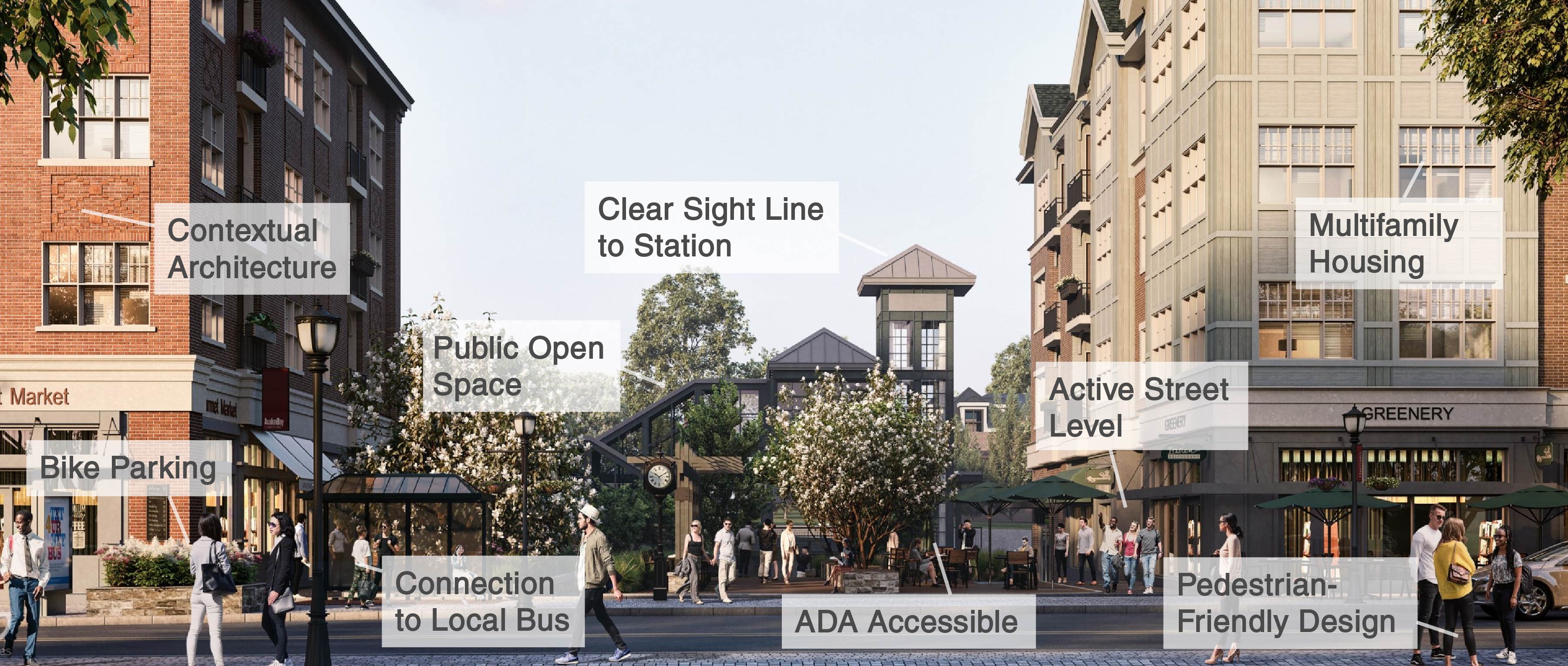
When building near transit, it's important to make design choices that complement the station area. See the image below for examples of transit-oriented design choices that should be included in developments around commuter rail stations.
-
Connection to station: Station is clearly visible and path to station entrance is obvious. Public space is located near the station entrance. ADA-accessible pathways are provided and centrally located.
-
Contextual architecture: Buildings fit the neighborhood scale and architectural character. They open to public areas and feature active ground floor shops with multifamily housing above.
-
Bus- and bike-ready: Bus stops and bike racks are placed close to station entrance, clearly labeled, and preferably sheltered.
-
Pedestrian-friendly design: Sidewalks and crosswalks are well-maintained, station area is well lit, streets have traffic-calming measures, buildings connect directly to plazas and sidewalks, not parking lots.
-
Thoughtful parking: Excess parking creates unnecessary costs for new housing and can create less walkable and less active public space. Parking should be carefully sized and placed to compliment public spaces and the pedestrian experience.
Station access and micromobility planning
From our buses and bridges to our subways and commuter rail, the MTA is committed to making our entire system convenient to access by foot, bike, and other personal wheeled devices. As part of this effort, TOD developed two initiatives that are ongoing today.
The First Mile Last Mile Toolkit
The first and last mile of a commute on Metro-North or LIRR refers to the portion that riders spend traveling to and from our train stations. While these trips are often made with cars, many riders walk, bike, or use personal devices like electric scooters, all of which are often more affordable and emit less carbon emissions.
As part of the MTA’s efforts to make station access more equitable and sustainable, TOD developed an interactive online toolkit that helps suburban communities identify and implement ways to make Metro-North and LIRR stations more accessible by foot, bike, and personal wheeled devices.
Key features:
- Interactive GIS Map local transit networks, geographic features, and land use layers
- Extensive Station Data (e.g. ridership, service, intermodal connections)
- Data Analysis Tools (e.g. access gap, prosperity, cost-benefit)
- Pilot program development and state/federal grant assistance
- Designated MTA staff to assist with toolkit use and project planning
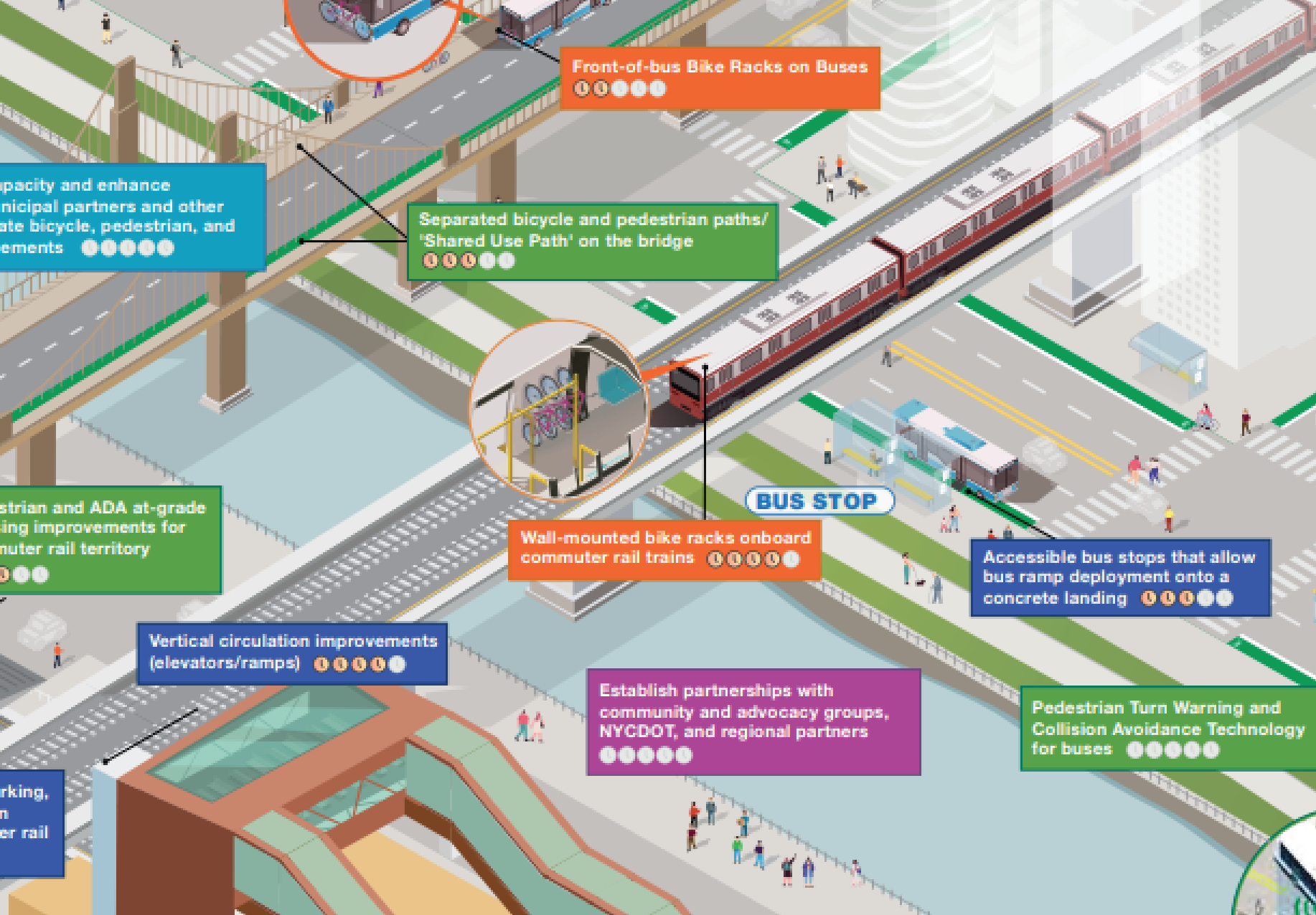
Extending Transit's Reach
In January 2023, we released Extending Transit’s Reach, a landmark strategic action plan that lays out short-, medium-, and long-term actions the MTA can take, in collaboration with regional stakeholders, to achieve more seamless, multimodal integration and connectivity for cyclists, pedestrians, and micromobility users.
Five key focus areas:
- Station Access and Mobility
- Multimodal Integration
- Safe Routes to Transit and Bridges
- Demand Management
- Policy, Program Administration, and Performance Management
Notable project outcomes:
- Installation of Bike Racks at 18 commuter rail stations and 37 NYCT Stations
- Installation of ramps and bike lanes on select MTA-owned bridges
- Front-of-Bus Bike Racks 3 new SBS routes & pilot program for additional routes
- Ongoing coordination of plan's recommendations by TOD
Suburban transit-oriented developments
TOD partners with municipalities and private sector developers to create new housing and mixed-use spaces adjacent to our commuter rail stations. In each project, our planners ensure that the developments are designed to complement the station area, considering important elements like multi-modal accessibility, active street levels, and the customer/pedestrian experience. See featured project profiles below.
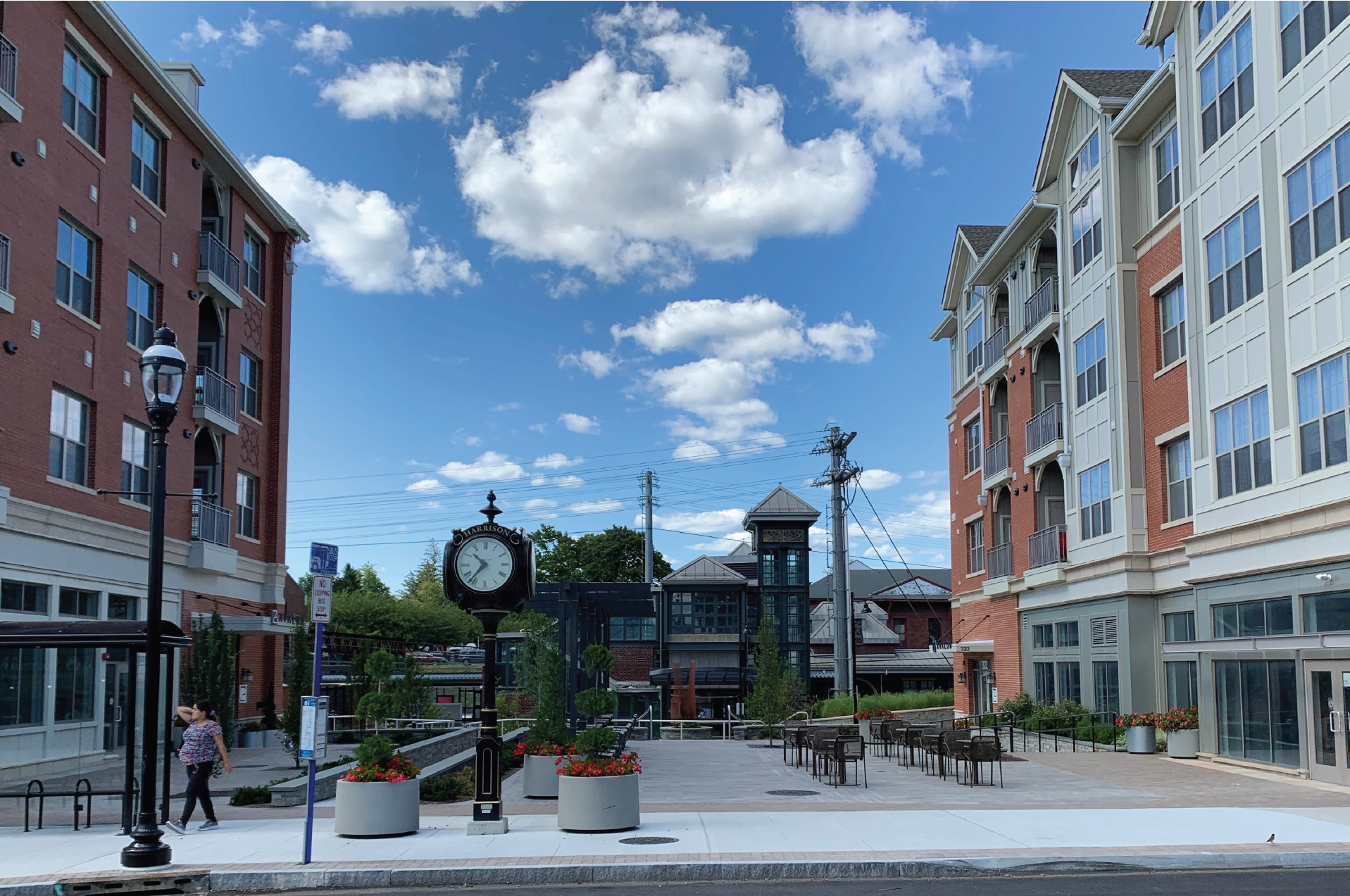
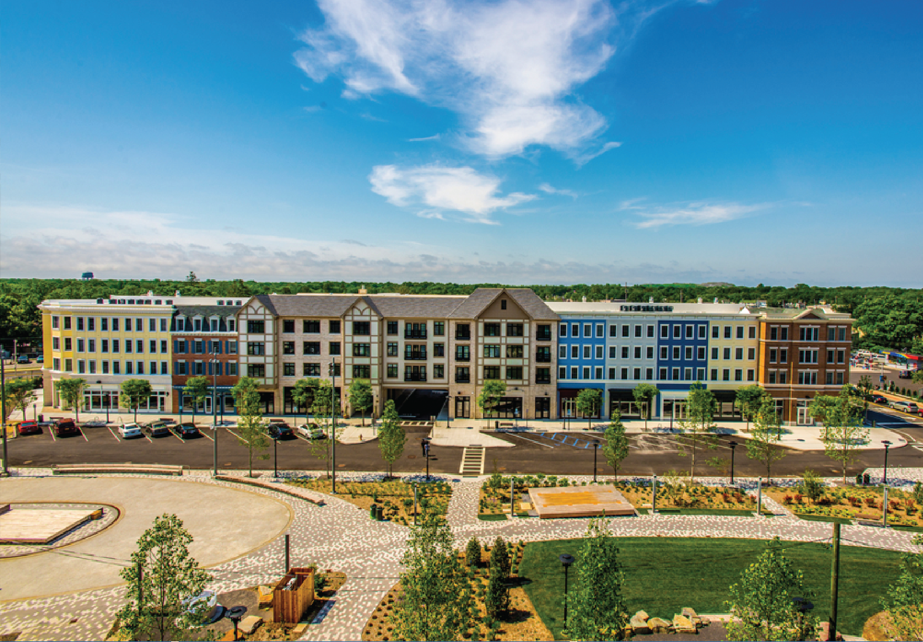
Harrison (MNR)
TOD and the Town/Village of Harrison joined forces to create a new transit-oriented development on the site Harrison Station's former three+ acre parking lot. Pedestrian-oriented four-story residential buildings lined with ground floor retail, pedestrian plazas, and a new parking structure create an improved experience for MNR riders and Harrison residents alike.
Project details:
- 143 residential units (7 made affordable by Westchester County)
- 27,000 square feet of vibrant, street-level retail space
- 2 public plazas with connections to station platform
- $15M shared parking garage financed/constructed by developer
Location: Harrison, New York
Status: Completed
Wyandanch Village (LIRR)
To help the Town of Babylon create a walkable, transit-oriented neighborhood next to LIRR’s Wyandanch Station, the MTA swapped land parcels with the town, constructed a garage, and rebuilt the station building in the historic railroad station style. The development boasts 300 residential units, a park, and a YMCA.
Project details:
- 300 new residential units
- New public park and YMCA
- New station building built in historic architectural style
Location: Village of Wyandanch, Town of Babylon, Suffolk County
Status: Completed