For languages other than English, use the Google Translate tool at the bottom of this page.
| Railroad Connection | At 69th Street 7 At Flushing–Main Street 7 At 46th Street–Bliss Street 7 At Jackson Heights–Roosevelt Avenue-Broadway E/F/M/R/7 At 52nd Street 7 At 111th Street 7 At 103rd Street–Corona Plaza 7 At 61st Street–Woodside 7 At 82nd Street–Jackson Heights 7 At 90th Street–Elmhurst Avenue 7 At Junction Boulevard 7 At Mets–Willets Point 7 At Woodside LIRR station At Flushing Main Street LIRR station At Murray Hill LIRR station Close to Mets-Willets Point LIRR station |
| Average Weekday Ridership on Local/Limited/SBS (within Queens) | 83,000 |
| Corridor Length in Miles (within Queens) | 7.3 |
| Average Ridership per Mile (within Queens) | 11,300 |
| East-West or North-South | East-West |
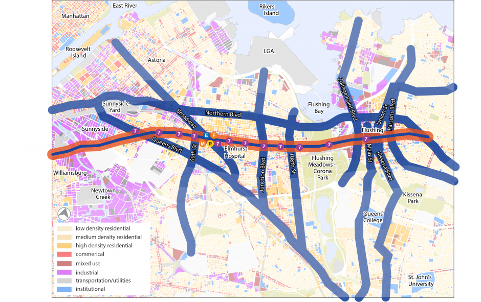
| Location | The 8 miles covered by Roosevelt Avenue (and Greenpoint Avenue) is dominated by the 7 train running overhead. Once Roosevelt Avenue runs east of Flushing, it just becomes another neighborhood street, no longer an important east-west corridor. |
| Local/Limited/SBS | B24 Q32 Q33 Q48 |
| Express | |
| NICE Bus | |
| Ridership Along the Corridor | Portions of Roosevelt Avenue have ridership, but usually just at subway stations where riders transfer from buses to the subway. |
| Land Use and Density | This corridor has solid urbanism throughout, based on the important subway line overhead. |
| Road Conditions | Buses running beneath the els are often slow due to the tight space constraints of the columns. Double parking and truck deliveries limit the ability to use this corridor for significant east-west bus travel. |