ClickAndGo Wayfinding offers multiple kinds of wayfinding solutions for the blind and low-vision community.
As part of the Accessible Station Lab pilot, ClickAndGo is offering two wayfinding solutions for the blind and low-vision:
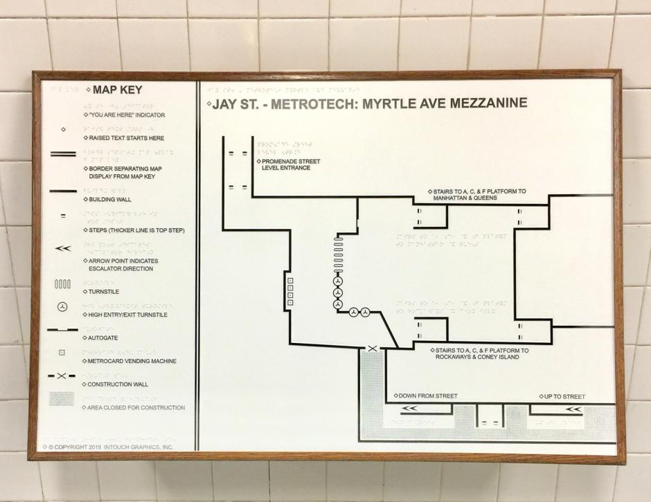
You may notice large black and white tactile maps on the station walls near the Jay St and Willoughby St entrance and the Myrtle Avenue entrance at MetroTech Plaza.
ClickAndGo also has a free app that provides detailed step-by-step audio directions and high-contrast route maps, all of which is also available on their website. The maps and the app work together with the tactile guideways in the station to guide users to their destination.
ClickAndGo Wayfinding App
The app and website contain a library with virtual tours of each mezzanine and more than 50 routes through Jay St-MetroTech station – you can start at any entrance and go to any platform using stairs, escalators, or elevators, and even connect to nearby bus stops. The app and website can help you find landmarks like the station booth or the new tactile maps of each station environment near the Willoughby Street and Myrtle Ave mezzanine entrances.
Try ClickAndGo's Wayfinding App Today:
Once you download the app from the Apple App Store, you’ll see three tabs at the bottom of your smartphone.
- Under Venues, search for and select “New York City Transit.”
- Use the Routes option to select a starting landmark and an ending landmark to receive step-by-step directions through the station.
- Under Settings, you can select Listen for Beacons for additional information as you pass through the station. You can also adjust the speed and pitch of the audio.
The ClickAndGo Wayfinding app is currently only available for Apple devices. Don’t have an Apple smart phone? You can also visit the ClickAndGo website before you come to the station and use their virtual tours, walking routes, and route maps to familiarize yourself with Jay St-MetroTech and the surrounding area. You can even download or print a large-print, high color-contrast map and bring it with you on your journey.
Available for download on the Apple App Store and Google Play!
Tactile Station Environment Maps
Near the entrances at the NW corner of Jay St and Willoughby St and at Myrtle Avenue, you will find a tactile map of the street-level surrounding the Jay St-MetroTech Station as well as the environments of each of the mezzanines where these maps are located.

The maps use a library of textures, explained in an accompanying map key, along with large print and braille. These features work together to help subway riders, especially those who are blind or low-vision, orient themselves to the station environment by identifying:
- Their location in the station
- The relative location of important station features like elevators and escalators, MetroCard Vending Machines, and the Station Booth
- The new tactile guideways, which help guide blind users through the station.
To learn more about ClickAndGo Wayfinding, visit www.clickandgomaps.com.
Tell Us What You Think!
If you have feedback, you can use our web form and select Subways and Compliment (even if your feedback isn't positive--we want to hear it all!) from the drop down menus. Then select A Station and choose Accessible Station Lab, and tell us in the comment field which feature or features you tested and what you think. You can also call 511 and tell us what you think.